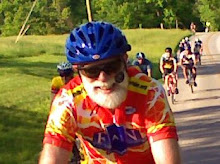
Monday, September 24, 2012

Looking for Norway


By Jim Schroeder

Sylvia and I were in Joliet, Illinois, visiting her children and tending to doctor appointments, but I managed to fit in a bike ride on Saturday.

I had contacted the Joliet Bicycle Club and was all set to go in the morning at 8am.  The rain had already blown through but it was still quite cold, 40's, and very windy.  Sylvia dropped me off at Chammahon State Park, one of the many state parks that are on the historic I & M Canal. Apparently they are fair weather riders, as I was the only one to show at the designated parking lot.  I grabbed the Illinois state map from the car and decided to venture west, while Sylvia drove into the western 'burbs for another appointment.

After about a couple of miles I was greeted with a last remnant of precipitation, but it was just a few drops and I was fully protected with my tights and rain jacket.  While riding along Hansel Rd, probably old US highway 6, it abruptly stopped to make way for one of those suburban housing additions in the middle of the country.  Well, at least they created a bike path where the road once was, and so I didn't get lost figuring the development's detour.

The route to Morris followed the I & M Canal and its pea gravel towpath, but I was advised not to take the towpath on my skinny-tired Kestrel. Instead I had to battle the breeze without any wind break.  The sun eventually broke through and it became a glorious but chilly morning, and I got to Morris and stopped at the Liberty Cafe for a chai latte and omelette croissant.  A couple of racer men, not boys, decked out in their kits, arrived as I was about to leave.  After some chitchat they wished me a better ride back with the wind, as they assumed that the cafe was the return point.

I had other plans.  After perusing the state map I decided to venture west and north to Norway and learn about my new wife's heritage.  Yes, this old German married one of those sexy Scandinavians!

I left Morris on US 6, which had minimal traffic due to its close proximity to I-70.  The NW winds picked up to a constant 20mph with gusts of 30mph. It was quite arduous even to this flatlander, and the day reminded me of a century named TASSLE I had done in Ohio some twenty years ago.  The Sunday return of TASSLE on the south shore of Lake Erie had gale force warnings from the west, and so was the worst day of my life on a bike.

I turned north just north of Seneca.  This area was ripe with French and Indian heritage: Joliet, Chammahon, Seneca, Marsailles, Ottawa, and Lasalle.  But, north of I-80 it became a little more rolling, still flat in a southern Indianan's view, and names became Scandinavian.  As I approached Stevanger, with the accent on the second syllable according to Sylvia, I came upon this grand farm house that had recently got a classy renovation.  
I then turned west again and tried to hide from the wind by hugging the few cornfields that were still left to harvest.  A few friendly horses greeted me as I stopped to say hello.
I turned north as I viewed down on the water tower of Ottawa and rode into what was used to be Danway, and then checked out the quirky Norwegian humor displayed along the road.


Then came my destination of today's journey, Norway, to learn something about Sylvia's heritage.
In fact I later found out that the road with the horses was where her aunt lived and the family farmed in the past.
Norway was a delight as evidenced by my photos, but I didn't go into the country store and sample the lutefisk!

I returned back to my daughter-in-law's in Joliet with rolling farmland surrounding me on a quiet US-52 with the long awaited tailwind.

A total of 73 miles and a whopping 1000 feet of climbing.

Wednesday, September 5, 2012

PRAIN in the Rain


By John Bassett

I believe one of the key ingredients to getting people to volunteer to work the BBC’s RAIN event is to provide a pre-do, or re-do, of the event so that those volunteers also get to participate as a rider.  This is something of a tradition and has gone by various names including, most recently, the BRAIN (Before RAIN) ride.  For various reasons, BRAIN did not happen this year.  However, a few individuals in the club expressed interest in a Post RAIN (PRAIN) ride, and I set about trying to get that organized.  In consultation with interested parties, a Saturday, September 1 date was set.  This was Plan A.

Plan A went awry when Hurricane Isaac moved into the area late last week.  We reset the date to September 3 (Labor Day) hoping to get behind the worst of the weather.  This became Plan B.  Unfortunately, we lost a couple of riders due to the date change but added Dana Marsh who had the day off.  After drenching rains on Sunday morning and some consternation over the advisability of a cross-state bike ride through a near-stationary tropical storm, a group of five riders, Jim Schroeder, Jen Miers, Laurence Kohler, Paul Toth, and John Bassett headed over to Terre Haute Sunday evening.  Stan Ellis and Dana deferred on a decision to ride until early Monday morning.  This became Plan C.

Monday morning in Terre Haute was dark, gloomy, and excessively humid - but at least the pavement was dry.  Rain chances were 60%, with thunderstorm potential, and a constant east headwind.  After a quick breakfast we headed to the start at the intersection of St. Mary of the Woods Road and US 150.  In the spirit of the event we put out an official RAIN traffic cone to mark the starting line.  We began at 7:43 AM, about as early as daylight conditions would allow.
My goal for the first part of the ride (before lunch) was to make sensible pedal strokes and to burn as few matches as possible.  The five of us worked as a group, alternating pulls, to the first designed rest stop at US 231 (38 miles).  The ladies got out ahead at this point following Jen’s ‘minimal-stop’ ride strategy.  The guys did not object to this since we were having difficulty with Laurence’s furious pace at the head of the line, anyway.

Meanwhile, Stan and Dana had decided to try it.  They started in the middle of the route near Southport Road and SR 37, rode the route backwards until encountering the Terre Haute group, then joined for the ride to Richmond.  The meeting point came near Stilesville on US 40.  We welcomed their additional help with the headwind.  Dana reported that the route from SR 37 to Stilesville was totally in the rain and lamented the fact that her shoes overflowed with water and made a lot of squishy noise.  This was PRAIN in the Rain.

We pretty much rode as a group of seven from Plainfield, along Camby Road, and across Highways 67 and 37 to our designated lunch stop at a Subway (Mile 79) at the intersection of Southport Road and Bluff Road.  The ladies opted to do a minimal ‘snack-and-go’ and got on down the road.  We wondered if we would see them again before Richmond, but lunch sure did hit the spot.  Here are the guys ready to go after chowing down.


The weather improved slightly on the southeast side of Indianapolis as the four guys kept a pretty brisk pace into an east headwind.  We nixed an optional stop at New Palestine and decided to press on to Casey’s at US 40 at Greenfield (Mile 111).  We got there just in time to see the ladies saddling up and heading off to Dunreith.  I was able to stay with Stan and Paul until Mile 126 at the grade just east of Knightstown.  The legs just did not respond to that hill.  The last 30 miles of this ride can be a real test of will.  The road is flat and should have been fast, but fatigue, a battering east wind, and blowing rain frustrated progress.  Various pains came and went, but soon Centerville appeared on the horizon (Mile 155) announcing an imminent finish in Richmond less than 5 miles ahead.

Pat Toth and Susan Bassett arrived at the official Earlham finish line ahead of us and set out our orange cone to mark the official finish.  Here is Dana admiring the cone at the conclusion of her second state crossing this year!


There was even an official medal presentation.  Here are our hard-working Jim and Jen accepting their medals.  RAIN could not have been done without them.


Laurence (above, right) enjoyed her medal by biting it Olympian style.  This was her longest ride ever, and she did a fantastic job battling the wind.

Comparing notes at the finish, it was apparent that all of the ladies had done the entire 159.6 mile RAIN route, which included a construction detour on US 40.  On the other hand, all of the guys blew through the construction zone and used no detour.  There is probably a life lesson here somewhere.  Here is an ad hoc comparison of the RAIN and PRAIN in the Rain events.
Criteria RAIN PRAIN in the Rain
Distance 159.6 miles
(with detour)
159.6 (ladies route)
156.9 (guys route)
Riders About 1,500 7
Riders Completing 1,216 7
Weather Hot
Dry
Headwind
Cloudy
Tropical Storm System
Same Headwind
SAG Support Optional Provided
Rest Stops Provided Optional
Orange cones
at Start / Finish Line
Yes Yes (0ne)
Medal Ceremony Yes You Bet !
On a personal note, I missed my best finish time by 3 minutes, which was a little disappointing.  But, considering the day-long headwind, a good average pace of 16.7 mph, and the fact that I felt very good at the end, I am not going to complain.  I got to spend the day with some good friends, and can’t complain about that either.  The GPS totaled right at 157 miles and a surprising 3,210 feet of climbing.  I had burned an estimated 8,400 calories which is significantly more than I had for lunch.

So, don’t be thinking you will miss a legendary ride if you volunteer for RAIN next year.  Despite the weather, this was a great substitute, complete with personal SAG support provided by Pat Toth and Susan Bassett.  We are all gratefully indebted to these ladies for making this a great ride.


Sunday, August 12, 2012

Sunday City Trail Rides


John Wrasse updates us on the new Family-Oriented City Trail Rides:

We have had a few regulars and have been happy to see them every week! Because of my schedule I have not been able to lead the past few weeks. I am hoping to continue these into the fall but would like to see more riders. I also need someone reliable to help me lead when I have to work.

We explored the east side today. The original ride was shorter than anticipated so we added on a trip to Southeast Park through Renwick. There is a nice hidden trail that is cool and quiet. Check it out sometime.

Thanks and hope to see some of you soon,

John

Friday, July 27, 2012

Remembering Will Streeter at RAIN


From Steve Parker, Wheaton, Illinois

This is just to say thanks to the BBC for putting on a great ride each year, and to tell a story.

Will Streeter, a close friend of mine from South Bend, was an avid cyclist and had done the RAIN ride several times alone over the past years.  Then about three years ago, Will was diagnosed with ocular cancer and had one eye removed.  But he kept on riding, and last year asked me and several other of his friends to ride the RAIN with one of his two teenage sons.  It was a great experience and we all enjoyed it immensely.  The first photo below is of that 2011 group at the finish, with Will on the far right.


This past spring, however, Will passed away at age 49 from his cancer, leaving behind his two sons and his wife.  There was some hope that Will would live long enough to do the 2012 RAIN, but when it became clear that wouldn’t happen, his sons decided to ride the RAIN in honor of their father. So before he died, Will asked me to organize a group to ride with them.  By July 21, we had over 20 family and friends from South Bend, Chicago, Tucson and Boston on our “Remembering Will” team, and a jersey that Will’s sons designed.  The second photo is of that group at the end of this year's ride.  Another of Will’s friends rode Will’s bike, which is in the foreground.


Will’s two sons rode the entire 160 miles, as did some of the others in our group. Others did parts of that distance, many achieving personal goals to ride distances they’d never done before.  Will’s sons crossed the finish line with huge grins, greeted by cheers and hugs from our team.  I wouldn’t be surprised if the two boys do the RAIN again, but 2012 will be the one they definitely remember.

So on behalf of our group I want to thank the BBC and all the other volunteers for their dedication and hard work to make the RAIN a great event!


Thursday, July 26, 2012

To Jim and Sylvia

 Friday is the wedding day of Sylvia Stoub and Jim Schroeder.


When has the BBC been the matchmaker between members? We have much to celebrate with them!

Jim served as a very successful RAIN director this year and has promoted bicycling in so many ways, especially those long and longer rides. Sylvia served as Volunteer Coordinator for RAIN and is our Social Chair, developing new ideas for club members to get to know each other besides on rides.

We join all the members of the club in wishing Sylvia and Jim many happy years together.

A cyclist's adaptation of the classic Irish blessing:

May the rain come gently in the night (we need it!)

May the day dawn bright and clear, 

May the day be not too hot (and not too cold), and

May the wind be always at your back.

Tuesday, July 24, 2012

RAIN 2012 Medallion

It's a small, but appreciated, touch to give each official finisher a memento. Note the iconic BBC "B" and cyclist, the background Indiana motif, the year, the mileage, and the block of dots that mirrors this year's t-shirt and jersey. Math geeks that my wife and I are, the first thing we did when we examined the t-shirt was to count the blocks, assuming they must somehow represent the year or the mileage or something. We never did figure it out!

RAIN Appreciation from Danville


From Dick Whicker, Danville, IN 

Have done RAIN a number of times starting in the early ‘90’s but not for perhaps 4 years.  Though older and slower now, I must say that this was the best I’ve experienced from the numbers of riders, the subtle change in locations of the sags at Plainfield and Greenfield, the start at SMOTW, to the subtle changes in route, particularly thru Indianapolis, that seemed safer than in years past.  I also thought the water wagons with the Gatorade syrup was a great idea as it cut down on the long lines.  Also having ice available was another great idea.  Food selection at the sags was also good, as usual.  I liked the assistance getting thru Terre Haute without having to stop all the time; wish the same could be said for Indianapolis but we too have to “share the road.”  For the most part I thought that motorists were considerate and we riders always need to be considerate too, including stopping when required and not barreling thru stop signs/signals unless motorists stop and allow us to proceed, which I experienced on several occasions.  For the most part when riders are courteous, drivers are courteous. 

As a race director myself, I recognize and appreciate the tremendous amount of effort that goes into an event of this magnitude, so a million thanks to everyone who helped in any and all ways!


Monday, July 23, 2012

RAIN 2012 Part II

This is a continuation of my post on this year's RAIN ride--one person's experience--just a small slice of everything that went on that day.

Last we heard I was changing a flat I shouldn't ever have had, still in Terre Haute. After that our group continued along without problems. It was great seeing those bank signs showing 62 degrees. We made a brief SAG stop around mile 20 and took our first real break at Rest Stop 1 at 231 and US 40. There we saw a few friends on bikes, and a number of club members volunteering to run the site. All was working smoothly. They had plenty of Port O' Johns, requiring only a short wait. It was my first experience with the water set-up where you get to choose your own GatorAde flavor in liquid concentrate. It worked well. It was also my first time to fill up with ice. I really appreciated having plenty of ice available at every stop. It would have been critical if the weather had been much hotter.

Continuing along we made it to Plainfield for the second stop. There we picked up another BBCer, Thom Simmons, who joined our group. Note all the nice shade!

Then we had the stretch on smaller roads as we worked our way south of Indy. This is an area where having good signage is very important. I can say that the combination of road marking and signs at turns was quite effective. Those back roads are a lot rougher and some of the chip and seal rattled my bones a bit and bothered my wrists.

We eventually got to the lunch stop in Franklin Township. Again it was well-organized, although a bit spread out, wrapping around the building. By this time of day, around 1:30 or so the lunch stop was probably beginning to wind down a bit. Having the pre-made lunches in bags was pretty effective. There was no wait to get food. Those Port o Potties were starting to get really hot in the afternoon sun, though.

Continuing along I really enjoyed new ice and drink stop just before getting back on US 40. We pulled into the shade and had some quick snacks and drinks. John Bassett was running the stop and snapped a photo of our group.


As Kathy said when she saw the photo: 110 miles and all still smiling! By this time we were all out beyond our longest rides of the year up to then.

We had another couple of brief SAG stops with Letha Taylor and Mark Gelhausen, plus the Dunreith stop at mile 129. At the latter we took our time. I had two popsicles and two cold orange drinks, used the facilities, even took off my shoes for awhile. Ken tried the mister and came back with a wet bandana over his head, under his helmet.


Altogether the last 50 miles were something of a slog, as expected. That's the time when you just have to buckle down and get the job done.

We actually out did ourselves toward the end, and arrived a little before we were predicting earlier in the day, rolling into the finish at 7:28. As the first-time finisher in our group, Gail led the charge up the final rise and into the finish line at Earlham.

We were all in a bit of a daze (at least I was) but none of us fell over or passed out. We appreciated being greeted by friends and volunteers at the finish line and had several pictures taken.


From that point on it was time for a little relaxing, a cold soda, and soon a warm shower. Even at 8 pm the showers were really busy, with a line, so that the showers didn't even get turned off between riders.

Then it was time to head home, with a quick stop for a bite to eat and to fill the gas tank. We finally arrived back in Bloomington around midnight, tired but happy.

A special thanks to a first-rate group to ride with, including CE Taylor, Ken Dau-Schmidt, Kathy Cummins, Gail Morell, and (for the last 100 miles) Thom Simmons. A double thank you to our SAG drivers, Letha Taylor and Mark Gehlhausen. And a triple thank you to RAIN director Jim Schroeder, his core of volunteer assistants, and the large cadry of club volunteers whose help made the day possible.

P.S. Many more photos and even movies are available on the web. Check out the RAIN Facebook page if you haven't already.

Sunday, July 22, 2012

RAIN 2012 Part I

Many of us are still decompressing from a very successful weekend, some club members riding and many club members volunteering to make our Ride Across Indiana a big success. Special KUDOS to the main organizers as well as the cadre of day-of volunteers who made it all possible.

I first rode RAIN in 2001, and didn't actually expect to do it again. But Tom Whitehead organized a Ride to Remember team through the palliative care unit at Wishard Hospital and I was one of 5 Bloomington riders who joined 40+ others. I rode with CE Taylor, Gail Morell, Kathy Cummins, and Ken Dau-Schmidt. Through OWLS we all knew we were compatible riders. We got organized and practiced our rotating pace line a few times and were prepared, as well as we could be.

Our group stayed at Saint Mary of the Woods overnight. We benefited from a special supper buffet provided by the Ride to Remember folks. The dorm accommodations were good and the breakfast buffet provided with the room was excellent. (Note to self: Next time you use your cell phone for a 5:15 am wake-up alarm please remember to turn it off. Being awakened at 5:15 on Sunday morning was not so nice.)

Here's our group just finished with last second preparations in the parking lot at SMOW:
(Note to self: if your tire is flat when you take it out of the car, just change it. Don't inflate the tire with its slow leak, only to have to stop within 5 miles or so to change it on the road.)

The start was neat, but we were so far back that we neither saw nor heard anything at the start. But the giant group of 1300+ riders started smoothly without incident. Here's a photo a bit closer to the start line than we were:
I like to follow bike routes on my Garmin Edge 605 and record basic ride data throughout the day. I was a bit concerned because the 4.5 year old unit has been acting a bit flaky lately. I missed a few minutes at the start because it seemed so slow loading and calculating the route that I started it over. Then 10 miles or so into the ride it just shut down. I bravely but without much hope restarted it on the fly. It started up again and performed perfectly for the next 12 hours! One amusing side effect of the missing few minutes of location data was that it got very confused about my max and average speed. Check out my maximum speed!:
The moving time is a little low because of starting about 3 minutes late and then having to re-boot. The elapsed time is a little high because I forgot to stop recording right away at the finish line. The average speed reflects the jump at light speed early in the ride. Earlier in the ride I had an "average" in the 50 mph range for a while. It gradually became more realistic as the day wore on. But the average moving speed is about right. This screen shot doesn't show the estimated calories consumed: over 9300.
And here's the recorded route:


Here we are changing my rear tire early on (thanks to Ken for the photo and thanks to everyone else for their patience):
One effect of this was that we were riding much more alone afterwards until we gradually started reeling in other groups.

To be continued.

Thursday, July 5, 2012

Mooresville Midweek "Century"

This week our head midweek centurion, Jim Schroeder, expected to be busy marking the RAIN route, with assistance from John Bassett and David Yeomans. Therefore during last week's century, the BSSM (Brownstown, Scottsburg, Salem, Medora) ride Jim worked to convince Joe Anderson to lead the next ride. The BSSM ride was a great drive-and-ride out of Brownstown, with great weather. It took no persuasion at all to convince Joe. So after a quick check with Barbara he said he would lead a drive-and-ride from Spring Mill State Park to the Overlook Restaurant at Leavenworth Indiana on the Ohio River. But as the intervening days wore on it became clear that we were trapped in a period of extremely hot weather. More than one rider and/or spouse questioned the wisdom of riding so far in such hot weather. With highs expected around 103 Joe therefore announced that we would do a long ride north from Bloomington, to Mooresville and back, leaving Bryan Park at 7 am on our bikes. As he noted it made no sense to drive during the best biking hour of the day. He also planned out a route with as much shade as possible and that had some "RAIN-like" qualities.

So two of us, Dave Tanner and I, joined Joe for this 85 mile "century."
The route up to Martinsville is totally familiar to BBCers as part of the club favorite M & M Ride. The 20 miles from Martinsville to Mooresville is flatter than anything we have around here. So we treated that part, coming and going, as RAIN training. We also did the 40+ miles from Bloomington to Mooresville without a stop beyond putting a foot down briefly at a traffic light, again as RAIN training for getting to that first rest stop.

The ride to Mooresville was actually quite enjoyable: not too hot, plenty of shade, and that 20 some miles of flat, smooth roads, along the Blue Bluffs road aka John Wooden Interurban Parkway, then through Centerton and Brooklyn. We got there some time after 10 am and had a leisurely breakfast snack at the local McDonald's. We all invoked our "senior drink" in order to be able to fill up our water bottles with ice and Powerade. After reading the Indy Star and eating a second helping and discussing the Higgs boson we by and by set out on our return to Bloomington, fully expecting several stops along the way.

We took the more westerly half of the north loop for our return, using the still fairly shady Goat Hollow Road.

After crossing 67 again, Dave pulled a big chunk of the way on the flat portion, averaging around 20 mph. Our little pace line was finally broken up in the outskirts of Martinsville when a semi slowed and then made a left turn in front of us. I just braked and gritted my teeth, but Joe went around me, then into the other lane to avoid slowing down so much. He then turned his head and let the driver have a piece of his mind. (I doubt the driver heard, of course.) After that we zigzagged our way through Martinsville to the McD's near 37. There, after dreaming of cold ice cream, I opted for a big chocolate chip mocha "frappé". We were all thirsty and beginning to get really warm. While there we visited for some while with the owner/operator, an old friend of Dave's (who had coached the owner's son in swimming some years back).

Eventually we had to get back on the road again. We opted for Hacker Road (the last part of the right hand loop) into Morgan Monroe, for offering more shade. Of course there was a trade-off: a humongous hill climb. I didn't stop, but I sure thought I might have to. The sweat poured out. From that point on I wasn't feeling so good and tended to lag behind a bit.

We stopped one last time at the Firehouse for drinks and to steel ourselves for the last few miles. Joe opined that we had done our six hills (3 out and 3 back), if you don't count Cascades. I said I count Cascades (at the end of a ride). It was a bit of a slog into town. We did use the new side-trail from Business 37 up to the stop sign at the road to Upper Cascades. Without any cars in our direction, Dave had to push the walk button to get a light change.

Soon we split up, with Dave heading home, Joe to a bike shop downtown, and me to home.

Despite the difficult weather I did experience for the first time on a bike the roads between Martinsville and Mooresville and also for the first time rode Hacker Road into the Forest.

I ended up with 85 miles, and an average in the lower 14s. By 2:20 I was home and the temperature was 102. My stomach was cramping a bit and I also ended up questioning the wisdom of biking so far in such hot weather. I was beat.

Saturday, June 30, 2012

Bloomfield Covered Bridge Ride

Another hot day and another long ride. Leader Stan Ellis had checked with the Green County Highway Department and found that paving had been completed in the Bloomfield area. So, except for the infamous Rock East we had quite a bit of good to excellent to brand new pavement. This is a difficult ride, but all agree it's not as difficult as last week's Williams Covered Bridge Ride.


We started with 16 riders and picked up another couple on the way out of town. Most did the whole ride but a few did judiciously opt for the 50 mile short option. The morning ride was a delight. Everyone in the main group made the trek out to the covered bridge before our lunch stop. (Thanks to John Bassett for taking this photo on CE Taylor's smartphone.)
If you look closely at the right you'll see CE and me, each sporting CamelPaks. This was my first time trying one. It worked out pretty well. I was able to stay much better hydrated and the back pack was not too hot or uncomfortable. I emptied two water bottles of Gatorade and one 70 oz CamelPak before our lunch stop at the Bloomfield Subway. Most of us had sandwiches and drinks there and were able to put ice and Powerade in our bottles.

After lunch we headed out on the return half of the ride. We followed up with stops in Springville and Harrodsburg. We were split into two groups, not too far apart and both groups generally tried to keep the pace down as the afternoon heat increased.

There were no mechanical problems beyond several dropped chains on hills. Everone managed the heat in his or her own way. Overall it was a good ride on a hot summer day.

Tuesday, June 26, 2012

Cool Midweek Century

Tuesday provided almost unbelievably nice weather for a long bike ride. Organizer Jim Schroeder found six other riders waiting when he pulled into Bryan Park just before 7 am. Joe Anderson, Dana Marsh, Laurence Kohler, Jennifer Miers, Allan Edmonds, and Clair Murphy quickly organized into three cars for the almost-an-hour drive to Brownstown. The temperature was in the upper 50s. In Brownstown we parked at a convenient CVS and met an eighth rider Dan Fowler who drove from home.

Check out the route map at this link. Especially take note of the elevation profile and total climb of 3907 feet. (My GPS measured climb at 4635 feet, probably too high; while Garmin's online site corrected the 4635 to 3069. In any case parts of the ride had significant climbs.)

We stopped at a country store in Little York around mile 30, at a service station in Scottsburg around mile 45, for a sit-down lunch at Christie's Cafe on the downtown square in Salem around mile 65, and for snacks in Medora around mile 89 or so.

Besides the beautiful weather, interesting sights included workers on scaffolding hanging from a large water tower (big bulb on a pedestal) while they repainted the tower and a now-defunct brick-making kiln dating from the 1800s.

We followed the planned route closely until near the end where Joe took us on a back-road portion of the Round Barn Ride route. I thought he was going to show us a round barn, but if so, I never saw it. The good news is that the route didn't add any significant distance and it had less traffic. The bad news was that some of it was old chip-and-seal, in bad shape, and shook us up rather well.

For the first half or more of the ride I averaged in the mid 15s (well the faster riders probably recorded higher numbers). I finished at 14.5 mph for the day.

The group stayed together pretty well. Thanks as usual to Jim for organizing a great ride and for taking care with some of us slower riders to be sure we made all turns and didn't fall completely out of touch with riders ahead.

Hot Double Century

The club already received a succinct report on this year's double century from participant Rudy Savich: "Hot!" Here the ride organizer, Jim Schroeder provides a more detailed report.


This was the 13th year that there has been a double century in Bloomington for the BBC.  The first eleven years it was known as Rudy's Double Century as Rudy Savich organized, mapped out the route, and provided support for the riders.  He also selected a charity that would benefit from any donations that any rider would have liked to make to that cause.  Last year did not have Rudy or a charitable cause as six BBC members rode to Paris, IL with the sag support of Eugene Kase.

This year I decided to resurrect the charity angle as the 2012 Tornado Double Century went to the Henryville, Indiana area where tornadoes ravaged that area this past March.  Many of us have ridden southern Indiana, and I thought it would be fitting for mostly fortunate Bloomington to give something back.  A local charity, HCC Recovery, was selected and several BBC members and a few Jim's CVS customers contributed to the cause.

6am at Bryan Park, three riders and a sag support driver started the journey.  I had tried to publicize this event and promote a "share a century" concept where riders could ride the first 100 miles and then help support the riders that were riding the last 100 miles.  That was not the case, and so, Sylvia Stoub drove the famous support Subaru with 3 "tifosi" golden retrievers while Nathan Rogers, Rudy Savich, and myself headed off on our two-wheeled steads.


Nathan had never attempted a double century and thought it would be a good test for his first RAIN ride a month later.  Rudy, mostly a marathon runner, decided to strart training  for this two WEEKS previous.  I had planned a grueling 200 miler with a "hill mongerish" 9,600 feet of climbing, but not the mid-90 degree heat in store for us!

We started the route with some familiarity as we paced down to Springville and Fayetteville, and then turned left on IN-150 through Eureka and then Bedford, which was actually new to Rudy.  The dogs kept us alert, as Gracie barked at every farm animal she saw.

Rolling to hilly but always enjoyable Tunnelton Rd was ridden, naturally, all the way to Tunnelton on the East Fork of the White River, as we now entered BBC uncharted lands through Bono and Cave River Valley, and highway 60 to Salem.  The country roads were some of the best I've encountered, and IN-60 had a nice shoulder.  70 miles showed on the computer so we decided to eat at a Subway south of the courthouse in Salem.

We veered onto a nice country up an downer, Martinsburg Rd, which ran parallel to IN-60, but the scenery was nice and the tree cover cooled our bodies.  We came back on IN-60 in Pekin, but that was okay as the state road avoid all the "knobs" that surrounded us on both sides of the highway.  After passing over I-65 we then headed north on US-31 and entered Henryville and stopped at Henryville Christian Church to hand over our donations of about $1500.  There was so much going on with all the construction of the school and many houses in town.  The Church was the mess hall for all the volunteers out there.  The kids enjoyed the dogs, while we enjoyed ice cream sundaes.  There was so much donated food that they even gave us boxes and boxes of Clif bars. Behind them, I understood the gesture: There was a 10 ft x 10ft x 10ft cubicle mountain of just Cliff bars!


At this 100 mile point, Rudy was tiring of all the hills dolled out on him, so we suggested that he ride on the flatter US-31 to Austin and Crothersville, while the rest of us went farther east and north to Marysville and Lexington.  There we followed the path of destruction on Henryville-Otisco Rd.  The heat and the country hills were pounding us, but nothing like the tornado that had pounded on the forests, houses, and churches throughout the countryside.

Nathan and I had hoped to meet up with Rudy somewhere between Austin and Crothersville.  Rudy even left us a sign, a red rag on a street sign but we missed it in Crothersville.  All of our cell phones had lost power by then, so there was no way to find him.  Brownstown was our last stop, and some remnants of some rain storms cooled the road off a bit as we now headed north on IN-135.  We even had one of those rain showers in the sun later, and that sure felt good.  We took the detour around the Kurtz bridgework, but we went the opposite way that the Nashville 90'rs went.  We had all the uphill!  Arrggh!


Finally, our last leg was IN-446, and it was quite desolate until we climbed Mellencamp Hill just north of the causeway.  Traffic piled up behind our sag vehicle and it was getting darker by the minute.  We still hadn't seen Rudy, so I decided that we should turn right at the Cabin Restaurant and go to Rudy's house to check on the situation. Rudy was actually ten to fifteen minutes ahead of us.  By then it was pitch dark.  I figured that 191 miles was long enough for a double century, so we all loaded up in the Subaru and dropped off Nathan.

-From Jim Schroeder

Sunday, June 17, 2012

Long, Longer, Longest


This past Saturday was a day of long and longer club rides. The official ride was the club favorite Nashville 90. That was the long ride.

Bob DeGroff led a group of 16 riders at the 9 am start. A few chose to do an out-and-back on 446, the only plausible short option.

Meanwhile some of the OWLS offered a slower but longer option, starting at 8 am and intending to a make a century out of it. I had planned out a route that added the detour laid out by Mike Finger to get around the bridge repair on 58, Bear Wallow (!) after Nashville, and Robinson Road/Firehouse Hill to finish up. Our group started with 11 riders. A couple opted to skip our extended stop in Nashville and just complete the standard 90. Another couple had to quit and call for a ride because of physical ailments.

The day started out nice and we made good time to Freetown where we snacked and drank and replenished fluids. As we proceeded toward Nashville the day got increasingly warm. We had a leisurely sit-down lunch in the shade at the General Store.

By the time we had climbed South Shore the remaining group mutinied and wisely decided not to do Robinson Road and Firehouse Hill. Yours truly ran out of gas and limped home with 98 miles. But Gail Morrell and CE Taylor both completed a true century by taking a sufficiently circuitous route home. That was Gail's first century and her longest ride ever. CE has done centuries before (not to mention 6 or 7 RAIN rides in a row). But this was his first century of the season. Congratulations to both.

It was a day for dehydration. That caused at least one person to drop out and it also helped keep me from completing a full 100 miles. That was just the kind of training we need to get ready for RAIN. More liquids and electrolytes needed!

Meanwhile, of course, Saturday was also the day of Jim Schroeder's Double Century event. We hope to hear details from that group soon. 

Tuesday, June 5, 2012

Venice Traverse

Tuesday marked the OWLS switching their start place from Sherwood Oaks Church to Bryan Park, like everyone else. The closures of the intersection of Sare and Rogers and of Harrell finally pushed us into it. For now we are experimenting with a 6 pm start so we stay a little bit separated from the other groups starting at 5:45. But we may go back to 5:45 if that's what people prefer.

We did a short ride north to mark the new start site, a simple 22  mile loop out and back on Bottom Road with a loop on Simpson Chapel and Lawson at the north end. Altogether we had 12 riders out for a gorgeous cool June evening.

The plan was to take in the Astronomy Open House on the top deck of the Henderson-Atwater Parking garage viewing the traverse of Venice across the sun. They were set up with filtered telescopes. But there was a huge crowd and none of us wanted to wait in line. I did take in club member John Carini's scope projection on a white board. The sun projected to a 4 inch disc and the small black dot corresponding to Venice was clearly visible.

Riding up and down the parking structure ramps on our bicycles was a blast. The Garmin GPS hardly knew what to make of it:

Monday, June 4, 2012

Inaugural City Trail Ride


By John Wrasse

Sunday, June 3rd, featured our first City Trail Ride. This ride is designed for new or returning riders to have fun while exploring the trails around town. Families are welcome! The rides will vary from 4-12 miles and will focus on how to ride safely in a group. We will meet each Sunday this summer to ride one of the routes.

Our first ride had 8 riders. We had kids in trailers and three others on bikes of their own. Everyone wore a helmet (of course) as we journeyed on Clear Creek trail from one end to the other and back.

Come and join us for a leisurely pace. No one will be left behind.

Next Sunday we will ride on the B Line. We will meet at the Showers Parking lot (where the market can be found on Saturdays) at 1:30 pm. For future City Trail Rides check the BBC ride calendar.

Wednesday, May 30, 2012

Columbus Century

It was another perfect day for another great midweek century. This time our leader Jim S had a route starting from Bryan Park and visiting downtown Columbus, which he christened "Columbus Day". The first and last legs--Bloomington to Nashville and Gatesville to Bloomington--were quite familiar. The middle part looping out to Columbus was much less familiar and totally new to me on a bike.

The weather was a bit cool, in the 50s for our 8 am start. But I was the only one wearing a vest and sleeves. I was happy to have them. But I removed the vest in Nashville and the sleeves in Columbus and had to carry them the rest of the way.

We had a great group of riders, at eight this was probably the biggest group of the season so far. Of these Brad was new to the club. For Clair and Laurence it was their first century of the season. The group was rounded out with Klaus, Allan, Tammy, and Dana.

We all stopped at roughly 25 mile intervals: snacks at the service station in Nashville, a sit-down lunch at Papa's Deli on Washington Street in downtown Columbus, and snacks and drinks again at the store in Gatesville.

Here are Dana, Brad, Laurence, and Tammy raring to get going again in Nashville (while Klaus chats on the phone):

The covered patio at Papa's Downtown Deli, with Tammy, Clair, Klaus, and Dana:


We took the westside "People's Trail", a dedicated bike and walking trail, from the outskirts of Columbus to near downtown, passing north of the motels, gas stations, and fast food along 46, through a tunnel under I-65 and a ramp, across the bridge (completely separated from car traffic), to near downtown.

At Papa's Deli we were able to order sandwiches and eat outside on their covered patio facing Washington Street. I had been dreaming of a ham and cheese sandwich on rye. But when I saw that their menu including vegetarian options I settled for the vegetarian delight cheese sandwich on a croissant.

Our lead group was going quite a bit faster than some of the rest of us. They did wait for us at the first two stops. After lunch we started together but gradually fell into two groups. Those of us in the slower group opted to take Klaus's short cut that supposedly saved about 4 miles including the 2 miles where the route dropped down to go along Highway 46. The trade-off was that the short cut involved a mile of gravel down a steep hill. We had dreams of getting to the store in Gatesville before the lead group. We were sorely disappointed to find them already there and, indeed, ready to take off. With that Tammy, Laurence, and Dana took off and were never seen again. Tammy reported back later by email that they didn't stop again, and arrived back at Bryan Park about 3:20 having averaged 16.9 for the day! I'm assuming they did the entire route as mapped. I tried unsuccessfully to come up with a good name for them, the "Iron Ladies"?

The rest of us took a break on the front porch. Here are Jim and Klaus on the porch:
Before leaving the thriving metropolis of Gatesville I paused briefly to take a picture of their iconic sign. I've been meaning to do that for years.

Brad headed off from Gatesville on his own. Pretty soon Jim left Klaus, Clair and me to take care of ourselves. It didn't take much convincing for us to follow Klaus's suggestion of a stop at the Port Hole, where we had a round of cokes before heading home.

I suppose we deserve a name, too. Again I'm not too good with names, but "Lazy Dogs" wouldn't be too far off. We tried to enjoy ourselves at least. Klaus opted for Shuffle Creek, while Clair and I took Tunnel and went back on 45. That was good enough for me since the mile each way from home to Bryan Park put me just over 100, with an average of 14.1 for the day.

Monday, May 28, 2012

Nashville 90 Detour


By Mike Finger
BBC Ride Director

For those of you who like to do the Nashville 90, you have probably heard by now that Hwy 58 is closed for bridge repair between Norman and Kurtz. The duration of this closure is predicted to last several months, meaning it will affect us most of the summer. I have ridden the 90 twice since the road was closed, and have been able to climb over and around the obstacles that are in the road both times. This makes the ride do-able, but hardly suffices as BBC policy for a club sanctioned ride.

There is a county road detour of modest length. When you come to the T on 58 at Norman do not take the left that would keep you on 58, but instead go to the right. The road sign there identifies this as 1250W. Take this road .9 miles to a left onto W450. At some point W450 morphs into 1100W. I never saw a sign for this change but immediately after going past a weird combination log cabin/barn type structure (on your left) the road takes a hard right presumably onto 1100W. After being on W450/1100W for 1.8 miles you will come to your next turn onto 400N, to the left. Follow this 1.8 miles to another left onto 975W. Stay on 975W all the way back to Hwy 58 (2miles). It comes out at the crest of the hill just past the bridge closure. Take a right there and you're back on route to Freetown.


Link to map at RideWithGPS.com.

The total detour is only 6.5 miles, and you've cut out several miles of Hwy 58, which means it will only add a couple of miles to your day's total. The road quality varies between 'not great' and 'excellent'. There are a few broken up spots on 400N, and the last mile plus on 975W is new pavement. There are a few hills.

Bon appetit!!


Memorial Day Breakfast Ride

By Allan Edmonds

This year has marked a renewed push to augment the regular BBC ride schedule with more social activities. Today's Memorial Day Breakfast Ride was one of those enjoyable events we've let slide in recent years. Today we had a total of 22 riders, 16 from Bryan Park and 6 more joining the route as it went by Ellettsville; in addition we had a couple spouses and children join us by car for breakfast at the Canyon Inn at McCormick's Creek State Park. After a double check we called the dining room at the Inn to let them know we were coming.

In the days leading up to the ride we fielded various email and phone inquiries, encouraging everyone to come out. We had a really eclectic group, as desired, from strong and experienced riders to a few for whom this was their first club ride.

Our group got to the park just after 9:30, with 18.5 miles on our computers. Once there we had a leisurely breakfast at the all-you-can-eat buffet bar. Eggs, bacon, sausage, biscuits, gravy, pancakes, french toast. Cereal, fruit, sweet rolls, etc. etc.


After breakfast some riders went with their families. The rest of us took a short loop through the park.  When we left the park, the Ellettsville group headed back the way we had come, while the remaining riders took the planned route down to Whitehall on Highway 43. We regrouped there before heading back via Highway 48 to Vernal Pike, into town, through town on the B-Line Trail. Here's a snapshot of the route and elevation profile.

The electronic version of the route at RidewithGPS.com is here.

Altogether everyone seemed quite pleased. Even on the ride, not to mention the breakfast, there was time to chat and get to know each other. Yes, it was leisurely. But we got in about 45 miles, and we were home before the heat really set in.

North Carolina Weekend

By John Bassett

I guess you are never too old to do crazy stuff.  So when the opportunity presented itself to join Jim Schroeder and Sylvia Stoub for a weekend bicycle jaunt to North Carolina, I jumped on it.  The primary goal of the trip was an ascent of Mt. Mitchell, North Carolina, which at 6,684 feet elevation is the highest peak east of the Mississippi River.  Starting in Swannanoa, just east of Asheville, Jim’s route involved a 92 mile loop ascending about 5,200 feet to top of mountain.  The route and profile are shown below.

We left Bloomington about 7:30AM on May 18.  A detour on I-75 due to a landslide on Pine Mountain, Tennessee slowed us a little, but we arrived at the campground in Swannanoa in time for a leisurely warm up ride out and back on the Blue Ridge Parkway.  Back at the campground we joined fellow BBC’er Jim Isenberg and his friend Ann for a great North Carolina barbeque dinner.  We spent the night in quaint camping cabins nestled amongst rhododendron and mountain laurel along a rushing mountain stream.

Early Saturday morning we started the mountain assault.  Isenberg and Ann had decided to try the assent from the west starting at the Appalachian Fork Art Center about Mile 86 on the map.  Schroeder and I cycled east generally on, or paralleling, US 70 through Black Mountain to Old Fort where we found a nice hole-in-the-wall breakfast joint.  I tried the liver mush – interesting, but I would not do it again.

Sylvia turned around at Old Fort and headed back west.  Proceeding east from Old Fort we navigated about 2 miles of gravel (this seems to be a theme on some of Jim’s rides) on Old Greenlee Road and at about Mile 26 turned north on NC 80.  There should be a sign that says the fun begin here.  Starting at an elevation 1,260 feet, one slowly climbs 2,100 feet over the next 12 miles to the Blue Ridge Parkway.  This is the route followed by the organized Assault on Mount Mitchell which was to happen the following Monday, May 21.  We saw painted markings on the pavement at this point indicating 74 miles.  So, these Assault dudes who start in Spartanburg, South Carolina have got 74 miles on their legs before they get to the fun stuff.  We allowed that a leisurely ride up the mountain two days before was preferable.

Never think the Blue Ridge Parkway is flat.  It ain’t.  Once on the Parkway at Mile 38 you are faced with another 3,200 feet of up to get to the top of Mt. Mitchell.  The grade is reasonable, but there is a lot of it.  There are an irritating number of Harley Davidsons and enough gnats get plastered to your face to make you unrecognizable to your next of kin.  Speed is not an indicator of progress.  Set your GPS to display elevation.

About Mile 49 we reached the turn off of the Parkway to Mt Mitchell.  The grade steepens.  I was running low on fluids.  But, about a half hour later you enter Mt. Mitchell State Park and enjoy gorgeous views along the crest of the Appalachian Blue Ridge.  Here is Jim at the top.

After a brief rest, Moon Pie, Coke, and other junk we started down.  This is not what you think.  There is still a remarkable amount of uphill to do along the rolling Parkway.  This adds a lot of climb to the total loop.  Finally at Craggy Gardens (Mile 68) we hooked back up with Sylvia and began to descend.  The 14 mile downhill back to US 70 is spectacular, slicing through dark mountain forests and open glade areas, and yes, the occasional tunnel requiring a bike lite.  On the steeper parts you just pretend you are a car and keep up with the traffic.  The Parkway dumps you back on US 70 just east of Asheville.  A little ride east and a nasty final climb gets you back to the Swannanoa campground.  This is a pretty good “almost century”, and a hilly one at that.  Owing to a couple of missed turns and some exploring we finished with 94 miles.  The GPS recorded a total climb for the day in excess of 9,000 feet.

After pizza and beer in Ashville we returned to the campground and compared notes with Jim Isenberg and Ann.  Their route up was our route down.  Their up and back to the top of Mt. Mitchell totaled 65 miles.  I think they both wished they had done the loop having found their ascent not too difficult.
On Sunday, both Jims, Ann, and I did a another Schroeder-designed 55 mile loop called the Hill of Some Concern, with Sylvia providing SAG support.  It features a little climb of the same name (800 feet with, as Ann counted, 18 switchbacks).  This little puppy is intense in spots and you learn to ride the outside of the lane where the grade is not as steep.  There is an interesting sign at the top which I was glad I did not see at the bottom.

The ride finishes with a nice 10 mile downhill back to Lake Luer, NC.  We finished the ride about 3:30 within sight of the spectacular Chimney Rock, now a North Carolina State Park.

After saying our goodbyes to Jim and Ann, and a mandatory ice cream stop up the road we began the long trip back home.  Bicycling stories abounded which made the trip seem shorter.  Still, it was 1:30 AM before we rolled back into my driveway.

Crazy as a weekend 900 mile round trip may seem, this sure was fun.  Thanks to Jim and Sylvia for organizing.  This seems to be becoming an annual club event.  I think I’d do it again.

Saturday, May 19, 2012

Hobbieville Ride


We had a relatively small group out for the Saturday club ride this week southwest to Kirksville, Hobbieville, Cincinnati, Solsberry, Hendricksville, and Whitehall.  A few members were off to North Carolina and quite a few were doing the Honor Ride at Crane. The club calendar also listed the Upland Gran Fondo in Louisville.

This was Tim Dowling's first time serving as a ride leader. He mentioned that he was just learning the route and had the idea of learning a route or two well so that he might specialize in those. Not a bad idea for others who might be thinking of leading a ride.

We planned stops and regrouping points at the Rock East turn, Cincinnati, Solsberry, and Whitehall. It eventually turned out that the convenience stores in Cincinnati and Solsberry have closed. The Whitehall service station was very busy.

As always the pavement on Rock East was rougher than any other road around. But they had at least patched the biggest holes.

As usual we broke up into at least two groups. My small group of 5-6 brought up the rear. We were able to sweet-talk someone at the Solsberry Fire Station into letting us refill water bottles.

The guy at the fire station told us that the Cook group has bought the old Yoho's and plans to renovate it as a classic country store. We'll look forward to that!

We took the Howard Road option out of Whitehall instead of the freshly chip-and-sealed 58 to Vernal Pike as recommended by Tammy. It is hilly. But I for one enjoyed the change of scenery and the fewer cars.

Coming into town most of our small group took the B-Line Trail from Adams Street down to First Street, which worked quite well.

Two others separated at Hartstraight in order to take a more circuitous route home and get some extra miles in the saddle. CE reports that by the time they got to Harrodsburg, they needed real food.   "We came up with the idea to split a hamburger.  That way we would get food but not so much as to make us sick in the heat.  Worked out well except I could have easily eaten the whole hamburger.  It was really good.  Then we headed back to town via the Dam Hill and Strain Ridge." Altogether they over 20 additional miles.

It was a warm day; the first serious training for the hotter days of summer. Highs reached the low 80s. But it was still very pleasant in the shade.

Tuesday, May 15, 2012

Midweek Century to Loogootee and Orleans

For the second week in a row I joined Jim Schroeder on his midweek century ride. This time we were only three, Jim and Dana M and me. I think Dana may have been on every one of these midweek centuries this year!

This week we did a 93 mile loop starting in Bedford. We left Bryan Park about 8 am by car. And left Bedford by bike about 9 am.

Here's a link to the route map. (It has some funny issues about the displayed mileage, adding 30 at Loogootee and another 60 at Orleans for some reason.)

It was a great route, a bit hillier than last week's, a bit shorter, and a bit warmer. I broke out my new insulated water bottles for the occasion. After adding some ice at our two rest stops I still had a little ice left at the end! There was a fair amount of chip-and-seal pavement and, indeed, Jim engineered t last minute alternate route to avoid fresh oil at one point. (Jim in fact drove the whole route the day before just to be sure everything was okay, since he hadn't been on it since last December.) Much of the route had good shade, which was appreciated.

We had our first lunch in Loogootee at about mile 34. There we bought drinks and just ate the sandwiches we were carrying. We had a second lunch at another convenience store in Orleans at about mile 64, where we all bought sandwiches and drinks. And we were back in Bedford before 5 pm.

When we got back to Bloomington, just a few minutes too late to greet the Intermediate Training Ride at Bryan Park, Dana hopped on her bike to add seven miles to make the day an honest century. Jim and I agreed we had had enough. Besides it perfectly balanced the 107 miles for last weeks über century.

BBC Social Event: Bike Maintenance

Monday evening saw one of an ongoing series of social events and "unrides." Club Social Director Sylvia Stoub is the major force behind creating these events, designed to be social and inclusive. She's prepared a full schedule of such events. Most of these are on Mondays or major holidays. Check club email and the calendar for details.

This week's social event was focused on learning about bike maintenance. We had a a small but lively group. The program was presented by Bob Holahan, owner of Bicycle Garage on Kirkwood.

Bob started by showing us what's in his seat bag and why he has it. He carries TWO tubes AND a patch kit, CO2 cartridges, multi-tool, three plastic tire levers, and either a small hand pump or a larger frame pump, depending on the bike he's riding. He and audience members shared various experiences and anecdotes about times it was good to have back-up equipment. Bob emphasized that one should practice at home in an unpressured situation doing things like changing tires, patching tubes, using CO2 inflators, etc. He shared a variety of tips about changing tires. He also fielded a variety of questions about dropped chains, mechanical failures, strange noises, likely causes of various common malfunctions.

Altogether it was a fun and informative evening.

More people would find these events worthwhile and fun.

Thursday, May 10, 2012

Midweek Century to Madison and Mt. Eden

We had a great drive-and-ride midweek century this week. No one showed up for the advertised Wednesday event, so it was rescheduled for Thursday, which attracted a group of six riders.

We drove in three cars to Brownstown, where we parked at the local CVS (naturally).

Click this link for the route map. The map doesn't do the route complete justice. Here's the elevation chart:
That hole in the hill at mile 45 or so shows the drop going south through Clifty Falls, followed by the climb along Highway 50 toward Hanover. The tower at Mile 95 or so is Rooster Hill. Except for these two somewhat extreme situations the terrain was actually more moderate than much of what we're used to around Bloomington.

Here's a photo by Klaus of the rest of our little group taking in the view of the Ohio River and the Clifty Creek coal-fired power plant on the river. There's Dana, Allan, Mark, Jim, and John.

Overall one could not have asked for a more perfect day. The skies were clear. The temperature maxed out in the upper 60s. We were all happy to have a second layer of one sort or another.

We enjoyed a long lunch break at the Inn at Clifty Falls State Park. We took several other shorter stops at country stores and even one coffee shop.

According to my GPS we did just over 107 miles in just under 7 hours of riding, for an average moving speed of 15.5. Including stops we were out just under 9 hours, so an overall average of about 12 mph. For the first 45 miles we averaged close to 17 mph. According to the GPS I had 3173 feet of climbing and burned 6748 calories.

Here we are at the top of the last big climb up Rooster Hill, looking pretty happy in a snapshot by John:


For three of us this was BY FAR our longest ride of the the year.

A special thanks to Jim Schroeder for organizing this ride, and for keeping any rider who fell a bit behind in his sights and helping to get them back to the group.