Wednesday, May 30, 2012

Columbus Century

It was another perfect day for another great midweek century. This time our leader Jim S had a route starting from Bryan Park and visiting downtown Columbus, which he christened "Columbus Day". The first and last legs--Bloomington to Nashville and Gatesville to Bloomington--were quite familiar. The middle part looping out to Columbus was much less familiar and totally new to me on a bike.

The weather was a bit cool, in the 50s for our 8 am start. But I was the only one wearing a vest and sleeves. I was happy to have them. But I removed the vest in Nashville and the sleeves in Columbus and had to carry them the rest of the way.

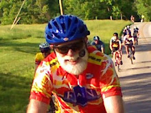
We had a great group of riders, at eight this was probably the biggest group of the season so far. Of these Brad was new to the club. For Clair and Laurence it was their first century of the season. The group was rounded out with Klaus, Allan, Tammy, and Dana.

We all stopped at roughly 25 mile intervals: snacks at the service station in Nashville, a sit-down lunch at Papa's Deli on Washington Street in downtown Columbus, and snacks and drinks again at the store in Gatesville.

Here are Dana, Brad, Laurence, and Tammy raring to get going again in Nashville (while Klaus chats on the phone):

The covered patio at Papa's Downtown Deli, with Tammy, Clair, Klaus, and Dana:


We took the westside "People's Trail", a dedicated bike and walking trail, from the outskirts of Columbus to near downtown, passing north of the motels, gas stations, and fast food along 46, through a tunnel under I-65 and a ramp, across the bridge (completely separated from car traffic), to near downtown.

At Papa's Deli we were able to order sandwiches and eat outside on their covered patio facing Washington Street. I had been dreaming of a ham and cheese sandwich on rye. But when I saw that their menu including vegetarian options I settled for the vegetarian delight cheese sandwich on a croissant.

Our lead group was going quite a bit faster than some of the rest of us. They did wait for us at the first two stops. After lunch we started together but gradually fell into two groups. Those of us in the slower group opted to take Klaus's short cut that supposedly saved about 4 miles including the 2 miles where the route dropped down to go along Highway 46. The trade-off was that the short cut involved a mile of gravel down a steep hill. We had dreams of getting to the store in Gatesville before the lead group. We were sorely disappointed to find them already there and, indeed, ready to take off. With that Tammy, Laurence, and Dana took off and were never seen again. Tammy reported back later by email that they didn't stop again, and arrived back at Bryan Park about 3:20 having averaged 16.9 for the day! I'm assuming they did the entire route as mapped. I tried unsuccessfully to come up with a good name for them, the "Iron Ladies"?

The rest of us took a break on the front porch. Here are Jim and Klaus on the porch:
Before leaving the thriving metropolis of Gatesville I paused briefly to take a picture of their iconic sign. I've been meaning to do that for years.

Brad headed off from Gatesville on his own. Pretty soon Jim left Klaus, Clair and me to take care of ourselves. It didn't take much convincing for us to follow Klaus's suggestion of a stop at the Port Hole, where we had a round of cokes before heading home.

I suppose we deserve a name, too. Again I'm not too good with names, but "Lazy Dogs" wouldn't be too far off. We tried to enjoy ourselves at least. Klaus opted for Shuffle Creek, while Clair and I took Tunnel and went back on 45. That was good enough for me since the mile each way from home to Bryan Park put me just over 100, with an average of 14.1 for the day.

Monday, May 28, 2012

Nashville 90 Detour


By Mike Finger
BBC Ride Director

For those of you who like to do the Nashville 90, you have probably heard by now that Hwy 58 is closed for bridge repair between Norman and Kurtz. The duration of this closure is predicted to last several months, meaning it will affect us most of the summer. I have ridden the 90 twice since the road was closed, and have been able to climb over and around the obstacles that are in the road both times. This makes the ride do-able, but hardly suffices as BBC policy for a club sanctioned ride.

There is a county road detour of modest length. When you come to the T on 58 at Norman do not take the left that would keep you on 58, but instead go to the right. The road sign there identifies this as 1250W. Take this road .9 miles to a left onto W450. At some point W450 morphs into 1100W. I never saw a sign for this change but immediately after going past a weird combination log cabin/barn type structure (on your left) the road takes a hard right presumably onto 1100W. After being on W450/1100W for 1.8 miles you will come to your next turn onto 400N, to the left. Follow this 1.8 miles to another left onto 975W. Stay on 975W all the way back to Hwy 58 (2miles). It comes out at the crest of the hill just past the bridge closure. Take a right there and you're back on route to Freetown.


Link to map at RideWithGPS.com.

The total detour is only 6.5 miles, and you've cut out several miles of Hwy 58, which means it will only add a couple of miles to your day's total. The road quality varies between 'not great' and 'excellent'. There are a few broken up spots on 400N, and the last mile plus on 975W is new pavement. There are a few hills.

Bon appetit!!


Memorial Day Breakfast Ride

By Allan Edmonds

This year has marked a renewed push to augment the regular BBC ride schedule with more social activities. Today's Memorial Day Breakfast Ride was one of those enjoyable events we've let slide in recent years. Today we had a total of 22 riders, 16 from Bryan Park and 6 more joining the route as it went by Ellettsville; in addition we had a couple spouses and children join us by car for breakfast at the Canyon Inn at McCormick's Creek State Park. After a double check we called the dining room at the Inn to let them know we were coming.

In the days leading up to the ride we fielded various email and phone inquiries, encouraging everyone to come out. We had a really eclectic group, as desired, from strong and experienced riders to a few for whom this was their first club ride.

Our group got to the park just after 9:30, with 18.5 miles on our computers. Once there we had a leisurely breakfast at the all-you-can-eat buffet bar. Eggs, bacon, sausage, biscuits, gravy, pancakes, french toast. Cereal, fruit, sweet rolls, etc. etc.


After breakfast some riders went with their families. The rest of us took a short loop through the park.  When we left the park, the Ellettsville group headed back the way we had come, while the remaining riders took the planned route down to Whitehall on Highway 43. We regrouped there before heading back via Highway 48 to Vernal Pike, into town, through town on the B-Line Trail. Here's a snapshot of the route and elevation profile.

The electronic version of the route at RidewithGPS.com is here.

Altogether everyone seemed quite pleased. Even on the ride, not to mention the breakfast, there was time to chat and get to know each other. Yes, it was leisurely. But we got in about 45 miles, and we were home before the heat really set in.

North Carolina Weekend

By John Bassett

I guess you are never too old to do crazy stuff.  So when the opportunity presented itself to join Jim Schroeder and Sylvia Stoub for a weekend bicycle jaunt to North Carolina, I jumped on it.  The primary goal of the trip was an ascent of Mt. Mitchell, North Carolina, which at 6,684 feet elevation is the highest peak east of the Mississippi River.  Starting in Swannanoa, just east of Asheville, Jim’s route involved a 92 mile loop ascending about 5,200 feet to top of mountain.  The route and profile are shown below.

We left Bloomington about 7:30AM on May 18.  A detour on I-75 due to a landslide on Pine Mountain, Tennessee slowed us a little, but we arrived at the campground in Swannanoa in time for a leisurely warm up ride out and back on the Blue Ridge Parkway.  Back at the campground we joined fellow BBC’er Jim Isenberg and his friend Ann for a great North Carolina barbeque dinner.  We spent the night in quaint camping cabins nestled amongst rhododendron and mountain laurel along a rushing mountain stream.

Early Saturday morning we started the mountain assault.  Isenberg and Ann had decided to try the assent from the west starting at the Appalachian Fork Art Center about Mile 86 on the map.  Schroeder and I cycled east generally on, or paralleling, US 70 through Black Mountain to Old Fort where we found a nice hole-in-the-wall breakfast joint.  I tried the liver mush – interesting, but I would not do it again.

Sylvia turned around at Old Fort and headed back west.  Proceeding east from Old Fort we navigated about 2 miles of gravel (this seems to be a theme on some of Jim’s rides) on Old Greenlee Road and at about Mile 26 turned north on NC 80.  There should be a sign that says the fun begin here.  Starting at an elevation 1,260 feet, one slowly climbs 2,100 feet over the next 12 miles to the Blue Ridge Parkway.  This is the route followed by the organized Assault on Mount Mitchell which was to happen the following Monday, May 21.  We saw painted markings on the pavement at this point indicating 74 miles.  So, these Assault dudes who start in Spartanburg, South Carolina have got 74 miles on their legs before they get to the fun stuff.  We allowed that a leisurely ride up the mountain two days before was preferable.

Never think the Blue Ridge Parkway is flat.  It ain’t.  Once on the Parkway at Mile 38 you are faced with another 3,200 feet of up to get to the top of Mt. Mitchell.  The grade is reasonable, but there is a lot of it.  There are an irritating number of Harley Davidsons and enough gnats get plastered to your face to make you unrecognizable to your next of kin.  Speed is not an indicator of progress.  Set your GPS to display elevation.

About Mile 49 we reached the turn off of the Parkway to Mt Mitchell.  The grade steepens.  I was running low on fluids.  But, about a half hour later you enter Mt. Mitchell State Park and enjoy gorgeous views along the crest of the Appalachian Blue Ridge.  Here is Jim at the top.

After a brief rest, Moon Pie, Coke, and other junk we started down.  This is not what you think.  There is still a remarkable amount of uphill to do along the rolling Parkway.  This adds a lot of climb to the total loop.  Finally at Craggy Gardens (Mile 68) we hooked back up with Sylvia and began to descend.  The 14 mile downhill back to US 70 is spectacular, slicing through dark mountain forests and open glade areas, and yes, the occasional tunnel requiring a bike lite.  On the steeper parts you just pretend you are a car and keep up with the traffic.  The Parkway dumps you back on US 70 just east of Asheville.  A little ride east and a nasty final climb gets you back to the Swannanoa campground.  This is a pretty good “almost century”, and a hilly one at that.  Owing to a couple of missed turns and some exploring we finished with 94 miles.  The GPS recorded a total climb for the day in excess of 9,000 feet.

After pizza and beer in Ashville we returned to the campground and compared notes with Jim Isenberg and Ann.  Their route up was our route down.  Their up and back to the top of Mt. Mitchell totaled 65 miles.  I think they both wished they had done the loop having found their ascent not too difficult.
On Sunday, both Jims, Ann, and I did a another Schroeder-designed 55 mile loop called the Hill of Some Concern, with Sylvia providing SAG support.  It features a little climb of the same name (800 feet with, as Ann counted, 18 switchbacks).  This little puppy is intense in spots and you learn to ride the outside of the lane where the grade is not as steep.  There is an interesting sign at the top which I was glad I did not see at the bottom.

The ride finishes with a nice 10 mile downhill back to Lake Luer, NC.  We finished the ride about 3:30 within sight of the spectacular Chimney Rock, now a North Carolina State Park.

After saying our goodbyes to Jim and Ann, and a mandatory ice cream stop up the road we began the long trip back home.  Bicycling stories abounded which made the trip seem shorter.  Still, it was 1:30 AM before we rolled back into my driveway.

Crazy as a weekend 900 mile round trip may seem, this sure was fun.  Thanks to Jim and Sylvia for organizing.  This seems to be becoming an annual club event.  I think I’d do it again.

Saturday, May 19, 2012

Hobbieville Ride


We had a relatively small group out for the Saturday club ride this week southwest to Kirksville, Hobbieville, Cincinnati, Solsberry, Hendricksville, and Whitehall.  A few members were off to North Carolina and quite a few were doing the Honor Ride at Crane. The club calendar also listed the Upland Gran Fondo in Louisville.

This was Tim Dowling's first time serving as a ride leader. He mentioned that he was just learning the route and had the idea of learning a route or two well so that he might specialize in those. Not a bad idea for others who might be thinking of leading a ride.

We planned stops and regrouping points at the Rock East turn, Cincinnati, Solsberry, and Whitehall. It eventually turned out that the convenience stores in Cincinnati and Solsberry have closed. The Whitehall service station was very busy.

As always the pavement on Rock East was rougher than any other road around. But they had at least patched the biggest holes.

As usual we broke up into at least two groups. My small group of 5-6 brought up the rear. We were able to sweet-talk someone at the Solsberry Fire Station into letting us refill water bottles.

The guy at the fire station told us that the Cook group has bought the old Yoho's and plans to renovate it as a classic country store. We'll look forward to that!

We took the Howard Road option out of Whitehall instead of the freshly chip-and-sealed 58 to Vernal Pike as recommended by Tammy. It is hilly. But I for one enjoyed the change of scenery and the fewer cars.

Coming into town most of our small group took the B-Line Trail from Adams Street down to First Street, which worked quite well.

Two others separated at Hartstraight in order to take a more circuitous route home and get some extra miles in the saddle. CE reports that by the time they got to Harrodsburg, they needed real food.   "We came up with the idea to split a hamburger.  That way we would get food but not so much as to make us sick in the heat.  Worked out well except I could have easily eaten the whole hamburger.  It was really good.  Then we headed back to town via the Dam Hill and Strain Ridge." Altogether they over 20 additional miles.

It was a warm day; the first serious training for the hotter days of summer. Highs reached the low 80s. But it was still very pleasant in the shade.

Tuesday, May 15, 2012

Midweek Century to Loogootee and Orleans

For the second week in a row I joined Jim Schroeder on his midweek century ride. This time we were only three, Jim and Dana M and me. I think Dana may have been on every one of these midweek centuries this year!

This week we did a 93 mile loop starting in Bedford. We left Bryan Park about 8 am by car. And left Bedford by bike about 9 am.

Here's a link to the route map. (It has some funny issues about the displayed mileage, adding 30 at Loogootee and another 60 at Orleans for some reason.)

It was a great route, a bit hillier than last week's, a bit shorter, and a bit warmer. I broke out my new insulated water bottles for the occasion. After adding some ice at our two rest stops I still had a little ice left at the end! There was a fair amount of chip-and-seal pavement and, indeed, Jim engineered t last minute alternate route to avoid fresh oil at one point. (Jim in fact drove the whole route the day before just to be sure everything was okay, since he hadn't been on it since last December.) Much of the route had good shade, which was appreciated.

We had our first lunch in Loogootee at about mile 34. There we bought drinks and just ate the sandwiches we were carrying. We had a second lunch at another convenience store in Orleans at about mile 64, where we all bought sandwiches and drinks. And we were back in Bedford before 5 pm.

When we got back to Bloomington, just a few minutes too late to greet the Intermediate Training Ride at Bryan Park, Dana hopped on her bike to add seven miles to make the day an honest century. Jim and I agreed we had had enough. Besides it perfectly balanced the 107 miles for last weeks über century.

BBC Social Event: Bike Maintenance

Monday evening saw one of an ongoing series of social events and "unrides." Club Social Director Sylvia Stoub is the major force behind creating these events, designed to be social and inclusive. She's prepared a full schedule of such events. Most of these are on Mondays or major holidays. Check club email and the calendar for details.

This week's social event was focused on learning about bike maintenance. We had a a small but lively group. The program was presented by Bob Holahan, owner of Bicycle Garage on Kirkwood.

Bob started by showing us what's in his seat bag and why he has it. He carries TWO tubes AND a patch kit, CO2 cartridges, multi-tool, three plastic tire levers, and either a small hand pump or a larger frame pump, depending on the bike he's riding. He and audience members shared various experiences and anecdotes about times it was good to have back-up equipment. Bob emphasized that one should practice at home in an unpressured situation doing things like changing tires, patching tubes, using CO2 inflators, etc. He shared a variety of tips about changing tires. He also fielded a variety of questions about dropped chains, mechanical failures, strange noises, likely causes of various common malfunctions.

Altogether it was a fun and informative evening.

More people would find these events worthwhile and fun.

Thursday, May 10, 2012

Midweek Century to Madison and Mt. Eden

We had a great drive-and-ride midweek century this week. No one showed up for the advertised Wednesday event, so it was rescheduled for Thursday, which attracted a group of six riders.

We drove in three cars to Brownstown, where we parked at the local CVS (naturally).

Click this link for the route map. The map doesn't do the route complete justice. Here's the elevation chart:
That hole in the hill at mile 45 or so shows the drop going south through Clifty Falls, followed by the climb along Highway 50 toward Hanover. The tower at Mile 95 or so is Rooster Hill. Except for these two somewhat extreme situations the terrain was actually more moderate than much of what we're used to around Bloomington.

Here's a photo by Klaus of the rest of our little group taking in the view of the Ohio River and the Clifty Creek coal-fired power plant on the river. There's Dana, Allan, Mark, Jim, and John.

Overall one could not have asked for a more perfect day. The skies were clear. The temperature maxed out in the upper 60s. We were all happy to have a second layer of one sort or another.

We enjoyed a long lunch break at the Inn at Clifty Falls State Park. We took several other shorter stops at country stores and even one coffee shop.

According to my GPS we did just over 107 miles in just under 7 hours of riding, for an average moving speed of 15.5. Including stops we were out just under 9 hours, so an overall average of about 12 mph. For the first 45 miles we averaged close to 17 mph. According to the GPS I had 3173 feet of climbing and burned 6748 calories.

Here we are at the top of the last big climb up Rooster Hill, looking pretty happy in a snapshot by John:


For three of us this was BY FAR our longest ride of the the year.

A special thanks to Jim Schroeder for organizing this ride, and for keeping any rider who fell a bit behind in his sights and helping to get them back to the group.

Down Nehrt

The OWLS Tuesday route took us out 45 to Tunnel Road, down Robinson to Nehrt, through the neighborhood the easy way. After a regrouping at the Fire House we took Bethel to Hinkle down to Lake Griffey and then back through town via Fee Lane.

Several back roads were pretty messy after the heavy rain on Monday night. Lake Griffey also look to have a lot of brush and mud and such washed in by the rain run-off.

Before descending to Griffey one rider had a flat (is this the first of the season on an OWLS ride?), which took some time to fix. I think it was a pinch flat. Unfortuantely the new tube was damaged during installation and a second tube had to be used. Nice to have prepared friends with spare tubes! I enjoyed offering my tire tool gadget that can pull that last difficult bit of a tire onto the rim without damaging the tube. It worked! I also offered up my little bike pump that performs like a small shop pump, so that you can hold it with a foot and put your body into it. We got a good 80 pounds into the tire that way.

We had 15 riders. I heard that the "Intermediate Group" had 23. We encountered the faster training group on the way out of town. They must have had 15-20 riders. That means that on a nice Tuesday evening we had upwards of 53 cyclists out for training rides!

P.S. Here's a link to a description of my VAR Tire Lever.