Tuesday, August 4, 2009

Larry Limestone Tour, August 1

By Allan Edmonds

It was an almost unbelievably perfect summer day and a perfect ride.

Jerry Arveson developed this new "drive and ride" route for a 56 mile loop starting at Heltonville, encompassing new territory on the south side and encompassing parts of Hoosier Hills rides on the north side. He included a 42 mile short option, cutting off a good part of the upper left loop heading back to Heltonville.

Larry Limestone Route Map

There were three riding groups taking part. A group of 8 or so "hammerheads" who opted to ride in the 22 miles or thereabouts from Bloomington, turning this touring ride into a century. A group of 6 or 8 OWLS types drove to the meeting place at the old elementary school on State Road 58. There was also a good female contingent, including one on her first Saturday club ride. Of course the dividing line between these groups wasn't entirely fixed. Altogether around 20 riders took part.

As Jerry reported, he adapted this route from a local fund raising ride he discovered on the web. He scouted it out carefully and prepared good maps for everyone. He made sure no one missed a turn at the two or three places he thought someone might go wrong.

Jerry planned three refueling stops. We stopped briefly in Leesville. Each group stopped at a little store old-fashioned shop in Buddha for quick refueling. Most took a second stop at a service station at the intersection of State Road 446 and US 50, requiring a 1 mile out and back on a slightly busy highway. (And those Hammerheads refueled again in Heltonville before heading for home.)


Stop in Buddha
I can't speak for the other groups, but the OWLS had a great day. It was a good distance and the weather was a treat. And it was fun to explore some new territory. And it was nice to sit comfortably in a car for the half hour drive back to Btown.

P.S. Whoever named that stretch along the southern edge of the route the Devil's Backbone knew what he was doing!

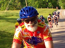
P.S.S. Mike Conway took the photo above and some more, which you can view at

Saturday, August 1, 2009

What's a Nice N Easy Ride?

By Allan Edmonds

The Sunday afternoon Nice N Easy ride is in many ways our club's most important ride. It is the place where newcomers to town and newcomers to bicycling usually start. It is often our first public face to prospective club members, after the web site.

Most of us can remember a time when we had never ridden more than 5 or 10 miles on a bike. We can remember when we didn't have toe clips, much less "clipless" pedals. For those who are unsure where they fit in to our club this is the place to start. For those who have been riding on their own and have worked up to 10 miles or more at a time, this is the place to move to the next level of 20 to 25 miles.

It's a good opportunity for more experienced club members to do a gentle recovery ride, too. In that case club members can help out be sure other, less-experienced riders are doing okay.

It's also a good opportunity for club members with kids to do a little family biking, if they're prepared for the distance.

For the last several years Ron Brown has been our unofficial de facto leader of the Sunday afternoon Nice N Easy rides. He has developed a repertoire of five rides that he rotates through, each in the range of 20 to 25 miles. He makes sure people understand the route, that people regroup occasionally and that reasonable stops are taken along the way. No one is in too much of a hurry. A typical Sunday ride takes close to 3 hours total, averaging perhaps 9 mph overall and 11-12 mph while actually riding.

Although riders on hybrids, or even mountain bikes, do sometimes take part, most riders will keep up more easily on a road bike with smooth, narrow tires, and with toe clips or clipless pedals.

Here are links to Ron's standard five maps for rotating Nice N Easy routes:


West Side Ride


Clear Creek Trail, Crop Circle, Tramway


Waterworks


East Side, Old SR-446, Pine Grove


Muscatatuck Ride

If you've been thinking that these rides might be for you, give them a try!

Triple Creek Tuesday, July 28

By Allan Edmonds


Brad and Beth Schroeder led a good ride following the BBC Triple Creek map, suitably modified to leave from the standard OWLS starting place at Sherwood Oaks Church parking lot. Beth had a flat at home and changed it, only catching up later, so Brad got the group organized on his own.

Here's a group picture taken at the church on Brummett's Creek Road. Click for a larger version.


Tom Whitehead and I opted to bypass the last couple of hills by coming in on 46. Very nice new pavement. Not much shoulder. But the road is wide enough that cars didn't seem to come too close as they whizzed by. We did have to climb. But it was longer and steadier....not to mention a somewhat longer distance.

Here's the basic route we took, proceeding clockwise around the loop.


For more photos go to album

West Side Nice N Easy, Sunday, July 26

by Allan Edmonds

Club members enjoyed a pleasant afternoon biking Ron Brown's West Side route on Sunday, July 26. Usually by this time of the summer it is too hot for me on a Sunday afternoon. But it was really quite nice.

Ten of us gathered in the shade on the grass at the south side of the Bryan Park Pool Parking Lot. After some chit-chat, we had Ron go over the planned route, so everyone new the plan.


We headed out Vernal and Woodyard to Loesch, then around Cook Incorporated and Ivy Tech. We went by the Airport, then stopped off at Karst Farm for a bit. Then it was by the Fairgrounds, which was a bit congested due to the County Fair, followed by That Road.

We finished up taking Clear Creek Trail and then neighborhood byways to get back to Bryan Park on Grimes Lane.

We covered slightly more than 24 miles in a little under 3 hours total, including slightly over 2 hours of riding, at a rate of 11.9 mph.

One rider dropped out on the way out of town, finding that he wasn't keeping up. Another, Tammy and her 3 year old on their tandem, got picked up at Karst Farm by husband Glenn. There's definitely a limit to how long a 3 year old can last on a bike.

Here's a shot of our rest stop at Karst Farm.

For more pictures check out
http://picasaweb.google.com/allan.edmonds/WestSideNiceNEasy#

Here's the basic route map. Note the cute little figure eight on the left!

Saturday, July 25, 2009

Riders 9, Dogs 0: Ride to Harmony, Thursday, July 23

by Tom Reynolds

At the start of our 26 mile ride out Victor Pike, to Harmony, to Ison, Leonard Springs, and home, we were treated to the welcome sight of Stan back on his bike after too long an absence. He's a fast healer! We all look forward to lots of rides with Stan for the remainder of the season.

The ride was both a figurative and a literal dogfight. The figurative dogfight was up the killer hill at the Oolitic quarry. Patrick was first to the top followed by Mike who seems to be getting stronger faster than humanly possible (youth, not a doping scandal). Unfortunately both riders disregarded my instructions at the start not to pass the leader on the big climbs and were therefore relegated to the back, just behind Tammy on her tandem. This made me the "official" winner of the climb!

We regrouped at the intersection of Victor Pike and Rockport Road for the jog up to Harmony. As we left the regroup point the literal dogfights began. We were threatened by the big dog across the road but as usual he stayed on his own property and we all went up the hill to Harmony untouched. We were all feeling good to have the dog threat behind us and no rain on the horizon--attested to by a rider who checked the weather radar via IPhone (and will remain unnamed). In the next 45 minutes we were nearly drowned by a deluge of Biblical proportions and attacked by 8 more dogs. The doggies failed to bring down and devour any riders (even the stragglers at the back of the pack) with the closest call being a big brown and black would-be killer who attacked on the downhill north of Harmony under cover of heavy rain.

Mother Nature, in an apparent act of contrition, brought out the sun to dry us and cheer us as we rode Ison to Leonard Springs and back into town. Thanks to all for a fun and adventurous ride.


Wednesday, July 22, 2009

Dam Ride, Tuesday, July 21

By Greg Simmons


Close to 30 riders did a 27 mile, mostly out-and-back ride to the Salt Creek Dam at the foot of Monroe Lake. The OWLS rides have been consistently drawing 15-20+ riders every week with varying levels of riding speed levels (much like the Saturday Club rides).


This date was 2 days after the R.A.I.N. Ride and several cyclists needed a “recovery” ride . I know I did!


The weather was perfect at around 70 degrees and was overcast but with no rain in sight. It was my first time on Ramp Creek since it had been repaved and it was very nice.


Thanks to Chris Tietz for leading the way up front while Terry and I rode sweep.


I will be leading another ride in a couple weeks that will be around 30 miles out to Bottom Road and back, so I hope we'll have another big turnout for that ride.


Photos from the ride, by Allan and Greg. (Click the image for a larger version.)


Greg distributes maps:

Tom models his new RAIN jersey:
Gathering at 5:45
Regroup after climbing Ramp Creek hill:
Turn around at the dam:
Final regroup at the Smithville PO


Sunday, July 19, 2009

Bloomington Criterium


By Allan Edmonds


This year the Bloomington Criterium, sponsored by local racing team Tortuga, ended up on the same day as the BBC RAIN Ride. It was a fun event for those of us not participating in RAIN (and even for a few who did RAIN!).


Here's the route for the race (about 0.55 miles):


And here's a snapshot of the Cat 3 (mid level, amateurs) racers making the corner from Grant onto Kirkwood by the Library. (Click on it for a larger version.)


For those not familiar with criterium racing, there's a general description at Wikipedia.